Showing posts with label Stanage Edge. Show all posts

Monday, 2 April 2012

1st April 2012 - Stanage Edge

1st April 2012 - Stanage Edge
(Collins Peak District Guide - 9.75 Miles)


We arrived in Hathersage just before 10am on a busy and Sunny sunday morning. Parked in the pay and display car aprk at £5 all day.

Walked back into Hathersage and headed Nother and up Baulk Lane into more open countrside, and a view of Stanage edge ahead of us.


North Lees Hall (above) is a Tudor tower house and one of the homes of the Eyre family, thought to be the model which Charlotte Bronte used for Thornfield Hall in her novel Jane Eyre. It is now used as holiday accomodation.


The Highland type cattle seemed formidable, but ignored us as we strode past.


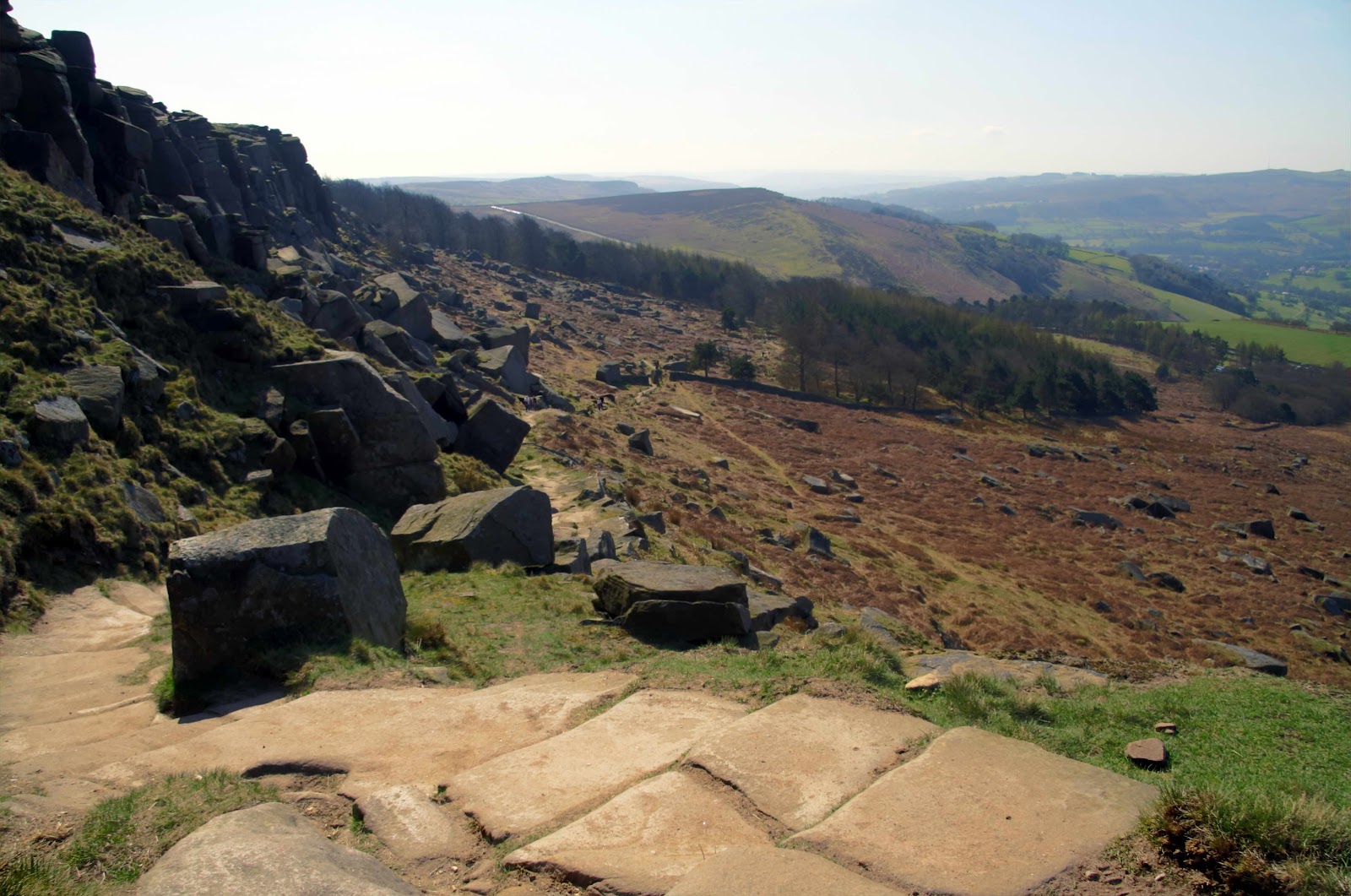
The view from the road as we approached the edge. Note there are loos here near to the road side, for a quick pit stop before the walk to the top.


The rock climbers were out in force and all paths were very busy, with everyone making the best of the warm day before the chill arrives forecast for next week.


Trekking along the top of the edge to High Neb, our turnaround point, and then back along a lower track, before ascending back up and following the edge in the other direction to the Cowper Stone.

Strange HDR prhoto effects (right) combines 3 images of the same scene at 3 differing exposures 2 stops apart.
This High Dynamic Range technique combines the high ranges of each exposure and depending upon the effects settings different effects from fairly neutral with punchier dynamics to strange colours and contrasts can be obtained. The example right is a little toward the wacker end of the scale, whilst the black and white image above is less so, but enhanced black and white dynamics overall.  


We took lunch (sarnies) at the turnaround point, and dropped to the lower path with the old mill stones evident. The path then allowed us to ascend once again up onto the edge after the point we had ascended earlier, and to head off along the edge in the other direction.
By now it was VERY busy (Picadilly Circus springs to mind)... Sunny Sundays eh!!


More of that strange HDR stuff, showing the contrast between black and white ans some funky tweaked colour shots (LSD anyone?). sue has a glow about her in the second shot, must be that Ready Brek she had earlier!


 Coming off the edge at the Cowper Stone we descended to the main road, following this right for a while and and diverting off righ and down a steep grassy descent and across Callow Bank.
Then we followed an easier 1 mile down Dale bottom and back into Hathersage.


Our Walk Score: 7.5/10 (Tip: Don`t go on a Sunny Sunday)

Sunday, 1 January 2012

Happy (Wet) New Year - Stanage Edge

1st January 2012 - Happy New Year!
(Stanage Edge - Peak District)

A Happy New Year to all our readers (we know who you are - Andy!)

Decided to celebrate the start of the new year with a short trip to Stanage Edge. The forecast was fairly good with 25% chance of rain predicted and higher chance later in the afternoon. It was fine (and a bit of sun) in Cleethorpes when we set off early-ish at around 8:45am.

We parked at Upper Burbage Bridge car park around 10:15, which is very near to the edge itself, rather than a long walk, this was set to be around 5 or 6 miles only, expecting rain by the afternoon. The car park was busy, and it is free, but no facilities, just a park site near the road, before Hathersage.

The weather looked very dull and rain looked likely.

We set off across the track leading up to Stanage Edge...


By Half-way up the rain decided to start early, so we sheltered for a while and then chose to press on to the top as the rain came down heavier. (A good test of the new gear though!, and guess what it worked, and kept me dry!)

We reached the trig point, and had to hold on as the wind was strong at the top, and with the lashing rain made it difficult to see as it blew into your eyes.

 
We had a look around at the top and took a few pictures, but decided the rain (and wind) were possibly here for the day so abaandoned any thoughts of pressing on along the edge.


We descended back to the car park, but decided we will  return on a finer, less windy day!

Sunday, 22 May 2011

Saturday 21st May 2011 - Peak District - Hathersage

Saturday 21st May 2011 - The Peak District (Hathersage)
Pathfinder Dark Peak Guide - Walk#23 Hathersage (8 Miles)


We travelled from our hotel in Manchester the morning after the Roger Waters gig, to Hathersage via the Snake Pass.
Arriving in Hathersage late morning we parked in a pay and display a few minutes walk from the town centre. This cost £4.70 for up to 12 hours.

Setting off towards the town centre, the day was quite warm with some sun and cloud. 
We stopped for a late breakfast at the bakery shop (Hot Breakfast buns), and picked up some cold sandwiches for later. Having forgotten my walking socks, we picked some up from one of the local walking shops in the town (Smartwool ones!.. nice). Picking up the rucksacs and changing back at the car park it was 11:30 when we set off on the walk.

We were soon out onto a lane, and then open fields after crossing Leadmill bridge and turning right off the main road.


We followed the path by the River Derwent for a short while before bearing off left through woodland which was covered in a carpet of Bluebells for the first few hundred yards. This then led out onto more open paths and fields with views across to Stanage Edge.


We descended and passed by Offerton house and Hall and crossed the River Derwent by way of the stepping stones.


Once over the river we followed various tracks and lanes with good views at several points across to the Hope valley.


Passing through Nether Hurst we followed Hurstclough Lane for about half a mile (no good views here though)  and past Greens House, after which were views right up onto Stanage Edge.

 
After following this track for about half a mile we entered woodland again, a little rockier than the previous wood. We found a pleasant spot on a bench by a stream in the wood and ate the sandwiches - very quiet no-one else around at all. In fact we had seen very few other people all the walk - guess most are up on Stanage Edge!


On leaving the woodland and following signage for Hathersage the final mile and a half of the walk took us across easy tracks and open field, before alighting back in Hathersage.
We did pass a pitch with the local cricket game in progress.......


We arrived back in Hathersage at the car park at around 15:30, having taken 4 hours to complete this pleasant low level walk. Despite the low level nature, the walk is quite undulating with some slow, long ascents and descents. The GPS log stated 1,800 ft of ascent and descent over the 8 miles.


Our Walk score: 6.5/10