Saturday 5 March 2011

Peak District 4th March 2011

Peak District 4th March 2011
Ashford In The Water and Monsal Dale
(Pathfinder White Peak guidebook - Walk 11 - 6.33 Miles)


We drove from the Samuel Fox Inn at Bradwell to Ashford in the Water, a distance of around 12 miles, so not too far. The day was similar to the previous and was cloudy and quite cold, but did not rain. We parked up in the village as there are about six or so parking places opposite the church (free parking).


Ashford in the Water is an attractive village of many limestone cottages built around the river Wye, and a 17th centrury 3-arched bridge known as the Sheepwash Bridge. It is only a couple of miles from Bakewell so you can reward yourself with a slice of Bakewell pudding or tart at the end!

Following the path out of the churchyard and across the road, we found the turn between some houses leading up towards open fields and a stile in the corner leading on to Pennyunk Lane.
This was a muddy track across open countryside, turning frequently for about 2 miles.


Pennyunk Lane then opens out to the spectacular view down into the Monsal Dale valley from Monsal Head. Here next to the Monsal Head Hotel is a good place to rest and enjoy the view of the old railway viaduct at the bottom of the valley crossing the River Wye. A real delight!


The viaduct was perceived as an ugly desecration of the dale and its construction opposed in 1863. Time has been kind, however, and weathered and harmonised it to the surroundings. The tracks of the St.Pancras to Manchester railway have now long gone though, having closed in 1968.
The bridge now forms a more tranquil use in the form of the Monsal Trail route from Buxton to Bakewell.


From here we descended down to the valley floor via a narrow and steep stepped track to the left of the rest spot. Care here as it was a bit slippery underfoot where the ground was still muddy.
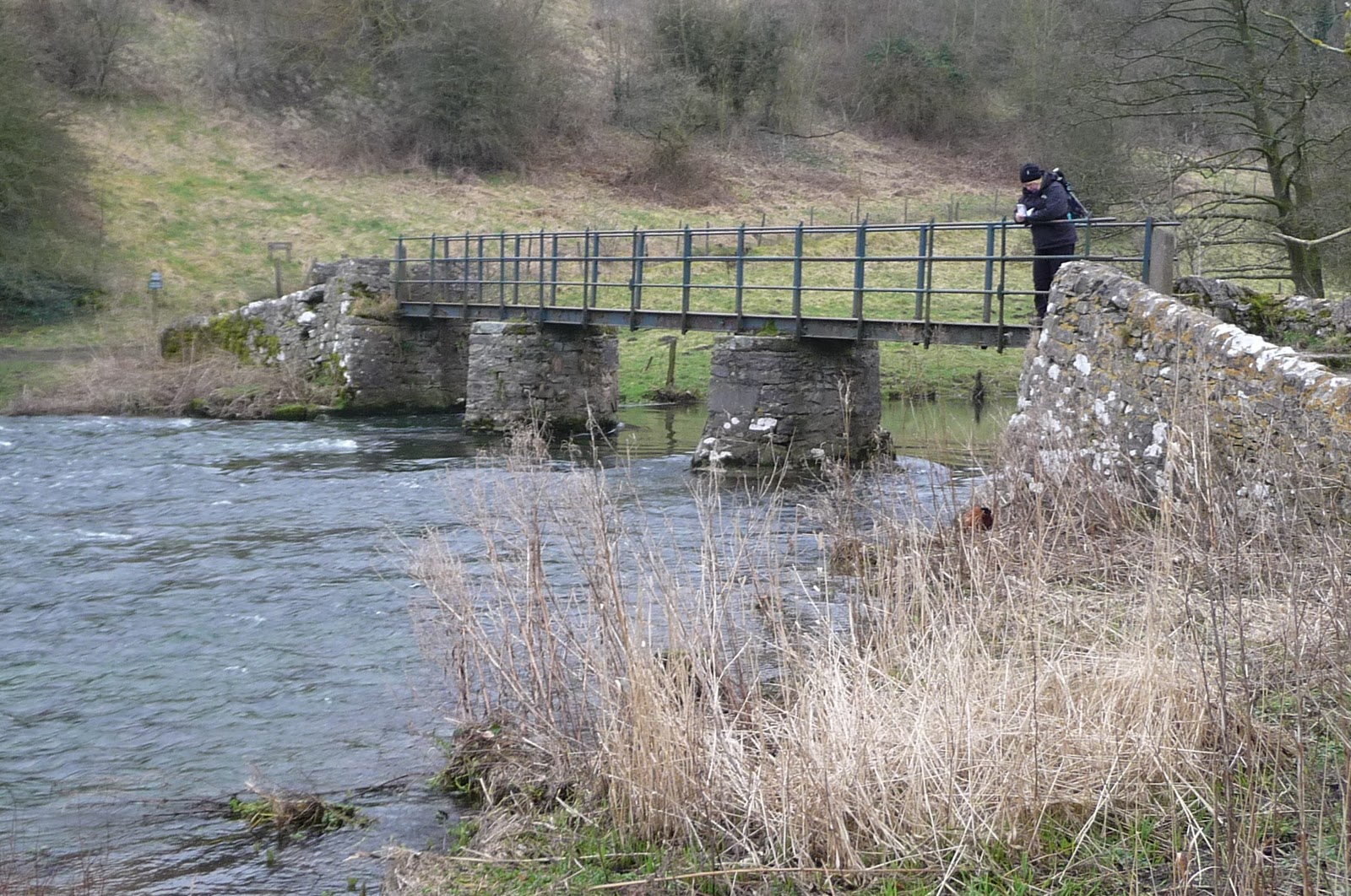
Arriving at the valley floor we crossed the river over a footbridge, and then looked ahead to the spectacular railway viaduct that we passed beneath.


Once under the viaduct the path opened out into grassy banks following the river Wye. This spot was very tranquil with the river here very still and calm, and the steep valley banks either side giving an enclosed feeling.


As the valley narrowed the river began to take on a more natural look becoming faster flowing  and swirling in deep pools over many weirs. After about 1.5 miles and crossing the main road a large car parking area with picnic benches and toilets made a good rest spot for a bite to eat.


The trail from the car park leads through rocker terrain, some stepping stones across streams and eventually a steep path into wood land. This path is the most strenuous part of the walk as the path rises very steeply, twisting and turning, flattening through woodland with steep drops to the left (but some good views down through the woodland to the valley below). It then descended through similair terrain, and care was needed as it was both muddy and rocky with tree roots across the path.


Susan feeling a bit out of breath after a steep climb!

Once out of the woodland section, after passing an old watermill, we passed though a succession of meadows and easier terrain for the mile or so remainder of the walk back into Ashford in the Water.


A walk of varying terrain and interest. A slow start the first 2 miles 
over open country and a meandering muddy track, but opening out to the spectacular Monsal Head and dale. The descent into the dale valley needed a little care, but worth the good views back up to the track where we walked earlier at the top of the head.
Very pleasant walking near the river and the wiers and it flows faster, followed by a pull uphill (and down) and the wood section with high drops and views to the left side. Then a pleasant meadow walk back to the village. Like the five dales walk the previous day, both good low level walks, though this one with the gem of Monsal Dale head to add some height!

Our Walk Score: 7.5/10

Thursday 3 March 2011

Peak District 3rd March 2011

3rd March 2011 - A Five Dales Walk
Pathfinder White Peak Guide - Walk 17 (7 Miles)


We arrived in Tideswell around 11:45 and parked street side for free. The day was cloudy and cold around 2-3 degrees, but dry. We set off around mid-day walking through the village past the church, then taking a left up some steps and left along a path above the village.


Following a lane to the right we passed through the village of Litton, turning right and across a stile through fields to Tansley Dale (the first of five dales of the walk). Here we saw evidence of old mine shafts and workings.


A little further on from here we arrived at the junction of Tansley Dale with Cressbrook Dale and a streamed crossing


Following the track right along the river we chose the lower path that meandered along the river bank. Here we found a suitable spot to eat lunch, assisted by many ducks that appeared to be very hungry for our packed lunches..


After a mile or so the surroundings changed to that of a forest track and we arrived at Cressbrook Mill (now converted into modern apartments)


Here we saw the old leat that once fed the water wheels, and a large mill pond. We took the path left to look at the weir, then followed the route right, past the limestone cliff. Here it was quite boggy, and would most likely be flooded and impassable if rains were heavy. Very pretty spot though.


Just after the lime stone cliffs, and beside the river Wye, we passed through the third dale of Water-cum-jolly and as the river narrows this became Millers Dale. The area here was really picturesque with steep grassy meadows falling to sheer cliffs to enclose the river and the path hugging the riverside


We arrived at Litton Mill (more converted mill apartments), and then Tideswell Dale, following a babbling brook back to Tideswell along easy paths and the start point.


The walk was just over 7 miles and took 3.5 hours. All in all a good varied walk without being strenuous, just a couple of short uphill sections. Despite the lack of high elevation and big views, the varied terrain and picturesque riverside sections made this a walk to be remembered and recommended. I would imagine summer weekends would be busy so perhaps try in the mid week.

OUR WALK SCORE 7/10

Once completed we drove to our accomodation in Bradwell, The Samuel Fox Inn.

http://www.samuelfox.co.uk/

Having stayed here before it is highly recommended, both for the comfort of the accomodation and the restaurant food. The Samuel Fox is a small inn located at the edge of the village adjacent the main road (so easy to find). It only has a small number of rooms (3), and all are tastefully decorated and very comfortable indeed. (Go for room no.1 with the bath) 
The restaurant food is of very high quality, the local house beer very good, and the breakfast is one of the best we have had - order the freshly baked croissants when you make your main order (as they take 15 mins to cook - fresh you see!).
Its not at the cheap end as you would imagine, but there is usually a deal of one night with 3 course evening meal and breakfast for £140/couple (which is not too bad with the 3 course meal included, and the quality of the food and service). In the winter months, we were on a deal of £99 for the above.