Thursday 23rd April
Catbells/Derwentwater Sunrise
Another early morning start (I must be mad), up at 5am again, and took the short drive to Hawes End.
The idea was to replicate some shots I took last year when we went up Catbells and a round of other fells in that area.
Last year the day being quite misty, today was crystal clear......
I parked up at the Hawes End car park (room for about 6 cars) at the base of Catbells.
The viewpoint is about half way up the first path (Catbells path can be split into two distinct main uphill sections). There is a small, grassy, flat point where the path twists and turns, offering a good vantage point.
After setting up and waiting a while (enjoying the peace, tranquility, and mirror view of the lake), the currant bun showed itself.

These shots were taken over several minutes with 0.9 ND Hard Grad, levels tweaked in lightroom, and applied a gradient filter to lighten the mountainscape a bit, due to the hard grad line. Though the overall result is fairly dark for the "mood" of the shot.


Once the sun was pretty much up, I played around a bit with the 70-300mm zoom, and the shot of the shoreline trees and shadows works fairly well I think.

Binsey
Back to the lodge (a pattern is emerging here!), a relax and breakfast, then we headed off to climb up Binsey (our one and only Wainwright fell this trip)


Binsey is located just north of Bassenthwaite village. Parking can be made at the base of the fell roadside, at a short widening of the very narrow lane. There was already about six cars there, but we managed the last spot. The day was warm again, (very lucky for April) and we set off through the gateway, uphill straightaway heading up Binsey.

Binsey is a nice easy fell with a steady, grassy, and obvious track to the summit at 1466ft.
The views were good all around, though hazy with the heat of mid-day.

We rested at the top enjoying the views towards the Skiddaw range.


The view in the other direction was less inspiring.


The remainder of the walk saw us continue over the top of Binsey, an easy descent, and then walking across pasture land, it was all very enjoyable.
We ate lunch at a good spot near a ruin of an old stone house (not much left of it), but a wide ledge to sit on and good views to enjoy. The worst part of the walk was the mile or so along the edge of a fairly busy A road (A591), befroe turning off left down the lane we had driven along to the parking pull in. This left us about two miles to walk along quiet lanes and a few uphill pulls before we were back at the start.

The view above from the lane back to the car.
Our Walk Score: 7/10
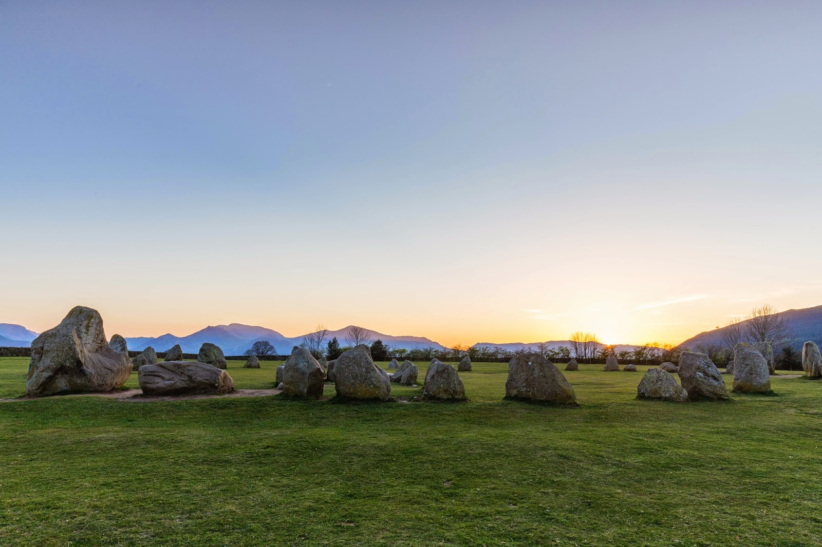
Friday 24th April
Friars Crag
A fourth early morning 5am start, making the most of the good weather, saw me heading off to the Keswick Lakeside. I parked up at the main Lakeside car park (free this early in the morning, bonus).
Walking down to the ferry jetties I decied to try for a better viewpoint further along at Friars Crag, it is a much used vantage point - so it must be good - right?
Its only about 15 minutes walk from the car park along the main shore path, and again I was alone there.

After setting up the tripod and trying a few different view points I "waited for the light".
The trees frame the shot well, so can see why this spot is used and so popular.


Shot below taken a little further back, wide angle including the much photographed bench at Friars Crag.

Once the sun was up I tried a few shots between 200-300mm as the sun/mist looked particularly effective


However, the weather turned by mid-mornnig, with rain and cloud. It was dry when we arrived there, but very cold and unpleasantly windy cycling, so after a few miles we abandoned the ride and headed back.
The afternoon was spent shopping at Lakeland, and a steady rest of the day back at the lodge.
Saturday we headed home, with the weather now heavy rain.
Still, we had a very fine week indeed!