Tuesday 19th April 2016
After scraping ice from the car.....an early morning short drive to the shore of Thirlmere was less productive than expected, with the road after the dam head barriered off to vehicles, and access gates down to the shoreline locked shut with danger notices. The floods had taken their toll and rendered parts of the shoreline with access restrictions.
Parking the vehicle near the shut up security hut I walked past the vehicle barriers a hundred yards or so and found a reasonable spot to set up for a few shots as the sun began to rise.
After half an hour or so, several security vehicles arrived and a big bloke started shouting at me!
After discussion it was OK though, and he just wanted me to move my vehicle a bit away to allow a couple of buses to pass through later (looks like they were been re-routed along the narrow side of the lake, as the main road had been closed for months following flood damage).
I carried on with a few more shots, though was not really that satisfied with the final results, having got much better shots in April 2015, right down at the shoreline.
So set off back to the lodge for a warm up and breakfast.
A decent day was forecast, so after breakfast we headed off to Rosthwaite along the Borrowdale road out of Keswick for a short valley walk.It had been a while since we had walked any distance so an easy start was the best thing we thought.
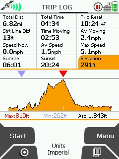
Borrowdale from Rosthwaite (Low level valley walk - 7 Miles)
The day was sunny when we took the last parking spot at the National Trust car park in Rosthwaite (£7 all day) and set off around 10:30.
This low level walk followed a good path along the river Derwent with excellent views of the fells and the Borrowdale valley. It was just too nice not to stop and take in the views and the tranquillity of the river.
Before long we departed away from the river into a wooded section (High & Low Hows Wood), with large stone walling, before turning and heading for Seatoller
Looking back near along the valley near Castle Crag, beautiful view, we stopped to eat lunch here.
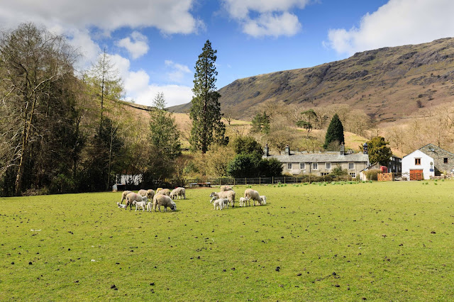
The afternoon by now was quite warm as we came down into Seatoller village and watched a local farmer herding his sheep and new born lambs.
From Seatoller we followed the path adjacent the main road for about a mile before heading off right across grassy tracks then joining a lane (part of the Cumbria Way) and back to Rosthwaite around 15:00.
A pleasant walk with only a few short uphill pulls and good views down the Borrowdale valley, and if you wish a climb up to Castle Crag (though we did not as we had been up there previously).
Our Walk Score: 6.5/10
Wednesday 20th April 2016
Cleator Moor to Rowrah Cycle Ride (12 Miles)
We drove about 45 mins from the lodge to Cleator Moor village on the Western edge of the National Park for a cycle ride along the old Whitehaven to Rowrah railway.
This is now an excellent path/cycleway, and we elected to pick this up at Cleator Moor rather than the more urban start in Whitehaven.
We managed to park on the edge of the village near to the cycle path on a road with terraced houses. From there it was just a few hundred yards to the railway bridge and then dropping down via a path to the cycleway.
The railway cycleway from Cleator Moor is fairly short at about 4 miles or so, but is a very well constructed path on a slight incline up in that direction.
It was pretty quiet as well, with just a few other bikes and dog walkers. Much quieter than the Keswick railway path.
The views were perhaps not a good as the Keswick path as the terrain on this edge of the park is much less mountainous. Very pleasant though on such a nice day
The path became a bit rougher towards its end and once it ended it gave way to narrow roads/lanes which got progressively hillier as they headed towards Ennerdale Water. Just before Kirkland we stopped at a rather nice looking bench seat with a view, ate lunch and then cycled back the way we came - and most of it was downhill - Nice!!
Our Cycle Score: 7/10


No comments:
Post a Comment