A bit of a dismal start in more ways than one.
Set off early from Cleethorpes to Edale, and hit a traffic jam at end of M180 for M18 that looked to be completely static. Decided for the long way round and kept moving by heading the other way on M18/M62 for M1 and Sheffield. Finally arrived at Edale car park around 09:45, boots on after waiting for rain shower to abate and set off for Jacobs Ladder/Kinder Scout just after 10am.


The weather was not too bad once we got going. Walking through Edale village and a wronh turn through a camp site, back tracking we found the trail (actually the start of the Pennine Way). Thought it would be a bit more obvious, maybe just us!


Start of Jacobs Ladder......
Jacob’s Ladder was named after Jacob Marshall, who created the original stepped path on the pack-horse route during the 18th century. At the nearby Edale Head House - now a ruin clinging to the hillside - he provided an overnight stopping place for the pack-horse drivers. These were known as ‘jaggers’, recalling their use of German ‘jaegar’ (‘hunter’) ponies originally bred to transport animal carcasses. Today the path is busier than ever, with a seemingly endless procession of walkers ascending and descending.

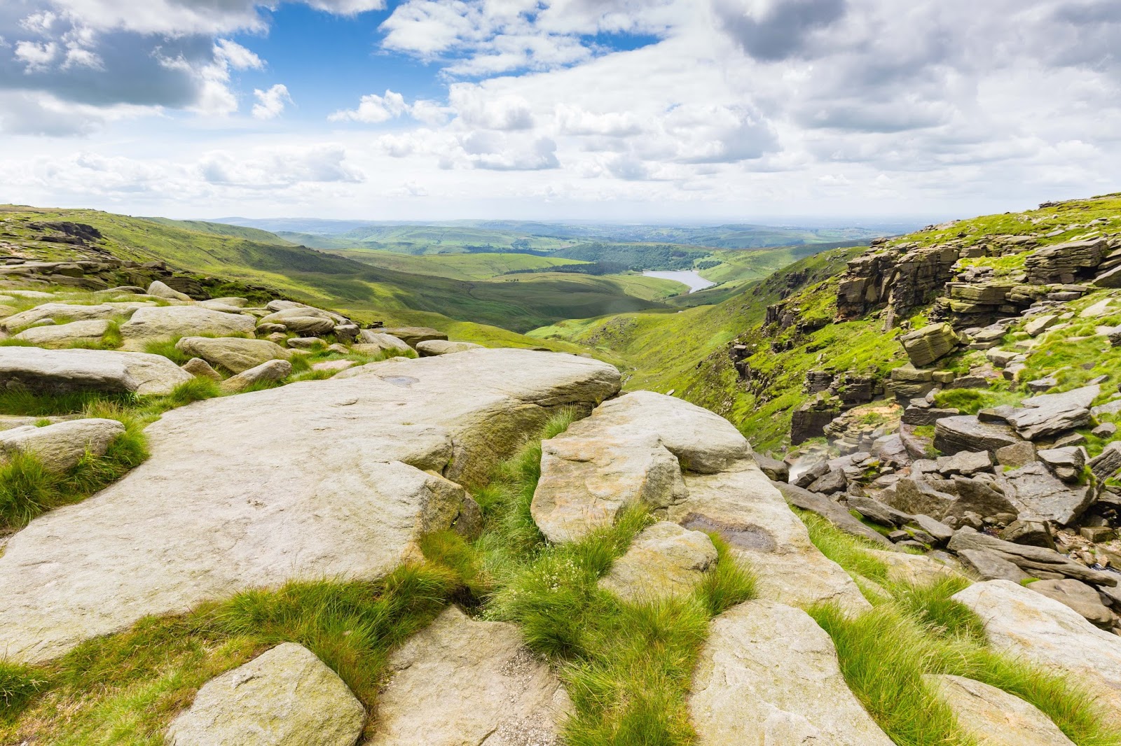
Actually a fairly pleasant ascent, taking it steady and stopping to look back at the views, its a good stepped path.


We rested, with sandwiches at the top, weather looking much better with some blue in the sky.

Rather than going the mainstream route that most seemed to be taking we had decided on the full monty route carrying onward to Kinder Low, Kinder Downfall and over Kinder Pleateau itself.

Trig point at Kinder Low, plenty of gritstone here, but not too hard going, just a bit of winding around the rock formations.

Kinder reservoir just appearing.......


Kinder Downfall, which was mostly going down today, but when the wind took it, spraying upwards, you could feel some of the spray when we were a bit closer later.


Turning right past Kinder Downfall was where the walk took a turn in itself (for the worst)
The path was OK at first, then we hit the first of the peat groughs and though there was a path of sorts it trekked along the edge of one of the many streams up there.
The whole plateau is one huge and undulating peat bog with hundreds of rivulets draining to Kinder Downfall. Some of the groughs are deep to the point where you cannot see above them.
We followed the stream edge, crossing it a few times, referencing the Satmap/OS Map, keeping on path, but did go off for a bit when not fully paying attention. A bit of backtracking and a cairn marker saw us heading in the right direction. Then the "fun" started.
The path, for what it was, completely disappeared, like it was impossible to go on following the stream ahead due to huge peat groughs. The only way on was to come out of the deepish "ravine", which we did, and wandered around in circles for a while trying to head in the right direction, looking for a path that did not exist, and meander around the huge peat groughs, avoiding particularly boggy bits.
Eventually something "gave", it was me, not paying full attention (again), to testing the ground with hiking pole, and found myself in a pickle. A bog trotting pickle.
Went down to the waist in the sloppy, foul smelling stuff. Unable to pull my legs out, as it really hurt pulling back and did not want to lose my boots. "Get me out" shouts to partner were fruitless and stupid on my part, so threw rucksack off, sticks, Satmap, and sort of rolled onto my front and pushed with arms, slithering like a human slug across the top of the peaty porridge. On safer ground, shaken and definitely stirred, cleaned much of the immediate slop off but boots, trousers and much of jacket soaked.
We met another couple looking for the path, who luckily did not see the "entertainment", but agreed we would stick together and eventually navigated around the obstacles without the peat monster dragging any of us under. I was tarred and feathered though, with hundreds of white "plant materials" adhesed to clothing. Eventually we saw the distant rock formations of Crowden Tower (previously there were no reference points to be seen to head to), and we found a path leading us to Grindslow Clough. (Below)


Ringing Roger route looked like a bit too far to get back to Edale, which left us with a slight ascent up Grindslow Knoll and down into Grindsbrook Booth. So after a short (and a bit blustery) ascent up and then a much more pleasurable slow descent down to Grinsbrook Booth shown below. Even with wet boots and socks, the sun was now out and drying me up a bit.
(Even the white plant material had blown off!!)


A more pleasurable 3 miles or so back to Edale

We arrived back at the car park a bit later than expected at around 18:20, looking forward to a somewhat soggy drive home. (The toilets were shut for drying off!)
I would say the walk was enjoyable up to Kinder Downfall, and the last 4 miles but the bit in the middle was rubbish. No matter what anyone tells you do not bother with Kinder Plateau, its rubbish!!
Our Walk Score: 7/10 (1/10 Kinder Plataeu)
No comments:
Post a Comment